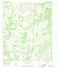
1966 Map of Desdemona
USGS Topo · Published 1969About this map
The settlement of Desdemona centers this mid-1960s survey, illustrating a landscape defined by the intersection of the Eastland Co Erath Co line and the winding course of Hog Creek. Once a booming oil town, the area is marked by numerous Gas Wells and active resource extraction, including several Gravel Pits and a Quarry along the Leon River. The terrain transitions from the elevations of Mockingbird Hill and Rattlesnake Mountain in the north toward the river bottomlands in the southwest.
Find a feature on this map
22 named features on this map. Tap any name to fly to it.
Don’t see what you’re looking for? This feature index may not catch every label — zoom into the map to look around manually.
Map Details
Editions of this 1966 Desdemona Map
This is the sole edition of this map. No revisions or reprints were ever made.
Other maps of this area

1890 · Stephenville
USGS Topo · 1:125,000

1894 · Eastland
USGS Topo · 1:125,000

1920 · Stephenville
USGS Topo · 1:125,000

1954 · Abilene
USGS Topo · 1:250,000

1958 · Abilene
USGS Topo · 1:250,000

1965 · Huckabay SW
USGS Topo · 1:24,000

1965 · Lingleville
USGS Topo · 1:24,000
1965 · Reddy Mountain
USGS Topo · 1:24,000

1966 · Kokomo
USGS Topo · 1:24,000
1966 · Bear Mountain
USGS Topo · 1:24,000