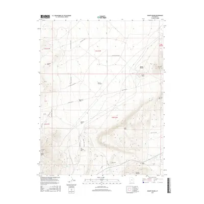
2017 Map of Desert Mound
USGS Topo · Published 2017About this map
The Escalante Desert meets the rising terrain of the Harmony Mountains in this survey of Iron County. The landscape is defined by the industrial legacy of Desert Mound, where complex mining infrastructure and roads like Desert Mound Rd indicate a history of heavy extraction. Moving south from the arid Neck of the Desert, the terrain climbs sharply toward Mt Claron and the high point of Swett Peak. A network of specialized transport routes, including the Neck Pipe Line Rd and several connectors like the Alt Foothills Connection, suggests a region organized around resource management. Along the southern slopes, features like Oak Springs Flat and the winding Duncan Cr provide topographic relief against the prominent peaks of the Antelope Range.
Find a feature on this map
40 named features on this map. Tap any name to fly to it.
Don’t see what you’re looking for? This feature index may not catch every label — zoom into the map to look around manually.
Map Details
Editions of this 2017 Desert Mound Map
This is the sole edition of this map. No revisions or reprints were ever made.
Other maps of this area

1885 · St. George
USGS Topo · 1:250,000

1891 · St. George
USGS Topo · 1:250,000

1949 · Cedar City NW
USGS Topo · 1:24,000

1950 · Cedar City NW
USGS Topo · 1:24,000

1950 · Kanarraville
USGS Topo · 1:24,000

1950 · Antelope Peak
USGS Topo · 1:24,000

1950 · Enoch
USGS Topo · 1:62,500

1950 · Iron Mountain
USGS Topo · 1:62,500

1950 · Cedar City
USGS Topo · 1:62,500

1950 · The Three Peaks
USGS Topo · 1:24,000