1941 Map of Desert
USGS Topo · Published 1967About this map
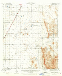
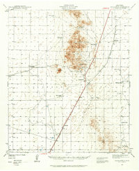
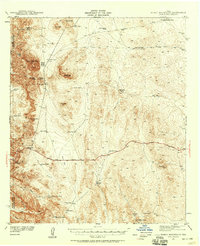
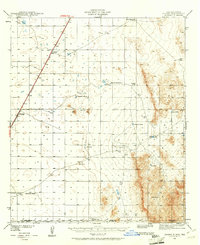
The Southern Pacific railroad cuts a diagonal line across this arid stretch of the New Mexico and Texas borderlands, anchoring a landscape defined by isolated ranching outposts and vital water catchments. Surveyed in 1941, the map documents the sparse settlement patterns of the era, where the small station of Desert and the community of Alvarado serve as primary points of human activity along the rail line. To the east, the rising terrain of the Hueco Mountains creates a dramatic backdrop for scattered landmarks like Three Buttes and Davis Dome.
Find a feature on this map
21 named features on this map. Tap any name to fly to it.
Don’t see what you’re looking for? This feature index may not catch every label — zoom into the map to look around manually.
Map Details
Editions of this 1941 Desert Map
2 editions found
Other maps of this area

1896 · El Paso
USGS Topo · 1:125,000

1903 · Cerro Alto
USGS Topo · 1:125,000

1908 · El Paso
USGS Topo · 1:125,000

1939 · Heuco Tanks
USGS Topo · 1:62,500

1940 · Heuco Tanks
USGS Topo · 1:62,500

1940 · Bassett Lake
USGS Topo · 1:62,500
1940 · Orogrande
USGS Topo · 1:62,500

1940 · Newman
USGS Topo · 1:62,500
1941 · Heuco Mountains
USGS Topo · 1:62,500
1941 · Desert
USGS Topo · 1:62,500