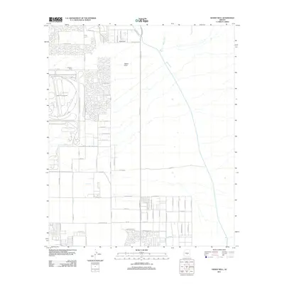
2011 Map of Desert Well
USGS Topo · Published 2011About this map
Desert Proving Grounds and the General Motors Proving Grands dominate the western landscape of this Maricopa County area, illustrating the region's long-standing connection to automotive testing and industrial research. The map captures a transitional moment for the desert terrain, where suburban residential grids are beginning to push eastward from Mesa toward open land marked by Siphon Draw and Weekes Wash.
Find a feature on this map
56 named features on this map. Tap any name to fly to it.
Don’t see what you’re looking for? This feature index may not catch every label — zoom into the map to look around manually.
Map Details
Editions of this 2011 Desert Well Map
This is the sole edition of this map. No revisions or reprints were ever made.
Other maps of this area

1900 · Florence
USGS Topo · 1:125,000

1902 · Florence
USGS Topo · 1:125,000

1904 · Desert Well
USGS Topo · 1:62,500

1906 · Desert Well
USGS Topo · 1:62,500

1907 · Sacaton
USGS Topo · 1:62,500

1954 · Mesa
USGS Topo · 1:250,000

1956 · Sacaton NE
USGS Topo · 1:24,000
1956 · Buckhorn
USGS Topo · 1:24,000

1956 · Goldfield
USGS Topo · 1:24,000

1956 · Magma
USGS Topo · 1:24,000