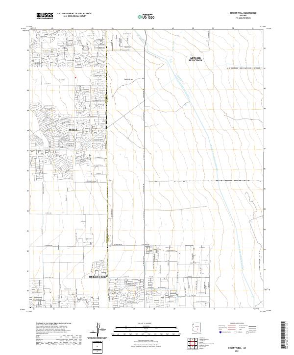
2021 Map of Desert Well
USGS Topo · Published 2021About this map
The growing desert communities of Queen Creek, Mesa, and Apache Junction converge in this modern survey of the Pinal and Maricopa county border. The landscape is defined by the rigid grid of suburban expansion meeting the natural desert drainages of Siphon Draw and Weekes Wash. A major engineering landmark, the Central Arizona Project Aqueduct, cuts across the eastern half of the map, illustrating the critical infrastructure required for settlement in this arid region. Near the center, the namesake Desert Well serves as a reminder of the area's pastoral roots, while to the north, the solitary outcrop of Hawk Rock stands above the developing residential blocks and planned thoroughfares like E Guadalupe Rd.
Find a feature on this map
138 named features on this map. Tap any name to fly to it.
Don’t see what you’re looking for? This feature index may not catch every label — zoom into the map to look around manually.
Map Details
Editions of this 2021 Desert Well Map
This is the sole edition of this map. No revisions or reprints were ever made.
Other maps of this area

1900 · Florence
USGS Topo · 1:125,000

1902 · Florence
USGS Topo · 1:125,000

1904 · Desert Well
USGS Topo · 1:62,500

1906 · Desert Well
USGS Topo · 1:62,500

1907 · Sacaton
USGS Topo · 1:62,500

1954 · Mesa
USGS Topo · 1:250,000

1956 · Sacaton NE
USGS Topo · 1:24,000
1956 · Buckhorn
USGS Topo · 1:24,000

1956 · Goldfield
USGS Topo · 1:24,000

1956 · Magma
USGS Topo · 1:24,000