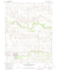
1960 Map of Deshler
USGS Topo · Published 1980About this map
Deshler serves as the central hub of this Thayer County landscape, situated along the southern reaches of a well-defined grid of agricultural land. The town's layout is meticulously detailed, showing local infrastructure such as the Peace Cem and St Peters Cem on the northwestern outskirts. The topography is defined by the winding course of the Little Blue River, which meanders through the central portion of the map, and the parallel path of Spring Creek to the south.
Find a feature on this map
15 named features on this map. Tap any name to fly to it.
Don’t see what you’re looking for? This feature index may not catch every label — zoom into the map to look around manually.
Map Details
Editions of this 1960 Deshler Map
2 editions found
Other maps of this area

1898 · Hebron
USGS Topo · 1:125,000

1955 · Lincoln
USGS Topo · 1:250,000

1957 · Lincoln
USGS Topo · 1:250,000

1958 · Lincoln
USGS Topo · 1:250,000

1960 · Bruning
USGS Topo · 1:24,000

1960 · Byron
USGS Topo · 1:24,000

1960 · Davenport
USGS Topo · 1:24,000

1960 · Chester
USGS Topo · 1:24,000

1960 · Carleton
USGS Topo · 1:24,000
1960 · Ruskin
USGS Topo · 1:24,000