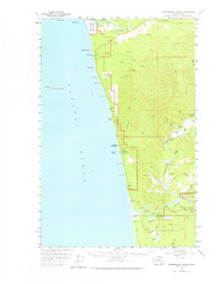
1956 Map of Destruction Island
USGS Topo · Published 1964About this map
The rocky coastline of the Olympic Peninsula is defined by offshore hazards and timber-dense watersheds in this mid-century survey. Destruction Island, featuring its isolated Lighthouse, stands as a prominent landmark off the coast from Ruby Beach. The landscape is a mix of protected wilderness and indigenous lands, including portions of the Olympic National Park, the Hoh Indian Reservation to the north, and the Quinault Indian Reservation to the south.
Find a feature on this map
63 named features on this map. Tap any name to fly to it.
Don’t see what you’re looking for? This feature index may not catch every label — zoom into the map to look around manually.
Map Details
Editions of this 1956 Destruction Island Map
2 editions found
Other maps of this area

1939 · Forks
USGS Topo · 1:62,500

1943 · Spruce Mountain
USGS Topo · 1:62,500

1943 · Copalis Beach
USGS Topo · 1:250,000

1951 · Copalis Beach
USGS Topo · 1:250,000

1955 · Taholah
USGS Topo · 1:62,500

1955 · Macafee Hill
USGS Topo · 1:62,500

1956 · Destruction Island
USGS Topo · 1:62,500

1956 · La Push
USGS Topo · 1:62,500

1956 · Spruce Mtn.
USGS Topo · 1:62,500

1956 · Salmon River
USGS Topo · 1:62,500