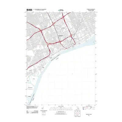
2011 Map of Detroit
USGS Topo · Published 2011About this map
Fort Wayne stands as a prominent historical anchor along the Detroit River in this 2011 survey of the Michigan-Ontario border. The map documents the dense urban grid and industrial infrastructure of Detroit, where transportation corridors like the Ambassador Bridge and Detroit Windsor Tunnel facilitate international transit. Large institutional footprints define the landscape, including the extensive campuses of Wayne State University and the University of Detroit. Genealogists will find the clustering of significant burial grounds particularly valuable, with Elmwood Cemetery, Mount Elliott Cemetery, and Lutheran Cemetery all detailed in the northeast quadrant.
Find a feature on this map
49 named features on this map. Tap any name to fly to it.
Don’t see what you’re looking for? This feature index may not catch every label — zoom into the map to look around manually.
Map Details
Editions of this 2011 Detroit Map
This is the sole edition of this map. No revisions or reprints were ever made.
Other maps of this area

1905 · Detroit
USGS Topo · 1:62,500

1905 · Grosse Pointe
USGS Topo · 1:62,500

1906 · Wyandotte
USGS Topo · 1:62,500

1912 · Wyandotte
USGS Topo · 1:62,500

1918 · Detroit
USGS Topo · 1:62,500

1918 · Grosse Pointe
USGS Topo · 1:62,500

1924 · Detroit
USGS Topo · 1:62,500

1929 · Wyandotte
USGS Topo · 1:62,500

1934 · Detroit
USGS Topo · 1:62,500

1936 · Wyandotte
USGS Topo · 1:31,680