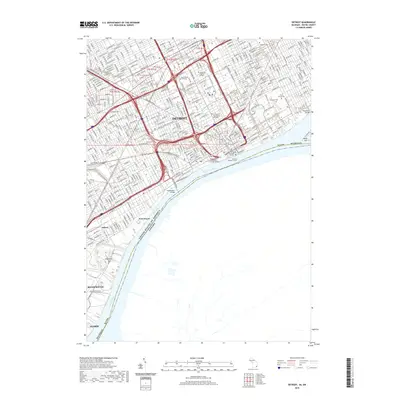
2019 Map of Detroit
USGS Topo · Published 2019About this map
Detroit dominates this landscape where the Detroit River forms the international boundary between the United States and Canada. The urban core is anchored by the Coleman Young Municipal Center and institutional grounds such as Wayne State University and the College for Creative Studies. To the northeast, a cluster of significant burial grounds including Elmwood Cem, Mount Elliott Cem, and Lutheran Cem preserves the city's genealogical heritage.
Find a feature on this map
29 named features on this map. Tap any name to fly to it.
Don’t see what you’re looking for? This feature index may not catch every label — zoom into the map to look around manually.
Map Details
Editions of this 2019 Detroit Map
This is the sole edition of this map. No revisions or reprints were ever made.
Other maps of this area

1905 · Detroit
USGS Topo · 1:62,500

1905 · Grosse Pointe
USGS Topo · 1:62,500

1906 · Wyandotte
USGS Topo · 1:62,500

1912 · Wyandotte
USGS Topo · 1:62,500

1918 · Detroit
USGS Topo · 1:62,500

1918 · Grosse Pointe
USGS Topo · 1:62,500

1924 · Detroit
USGS Topo · 1:62,500

1929 · Wyandotte
USGS Topo · 1:62,500

1934 · Detroit
USGS Topo · 1:62,500

1936 · Wyandotte
USGS Topo · 1:31,680