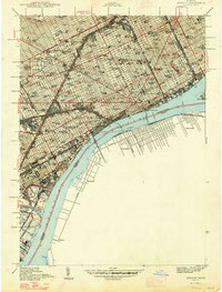
1947 Map of Detroit
USGS Topo · Published 1947About this map
The industrial and civic heart of the City of Detroit is captured here just after the war, revealing a dense grid of schools, hospitals, and heavy infrastructure. The Detroit River serves as the central artery, separating the city from Ontario settlements like Windsor and Sandwich. Major landmarks of the era are clearly visible, including Briggs Stadium, Wayne University, and the Ford Hospital.
Find a feature on this map
140 named features on this map. Tap any name to fly to it.
Don’t see what you’re looking for? This feature index may not catch every label — zoom into the map to look around manually.
Map Details
Editions of this 1947 Detroit Map
This is the sole edition of this map. No revisions or reprints were ever made.
Other maps of this area

1905 · Detroit
USGS Topo · 1:62,500

1905 · Grosse Pointe
USGS Topo · 1:62,500

1906 · Wyandotte
USGS Topo · 1:62,500

1912 · Wyandotte
USGS Topo · 1:62,500

1918 · Detroit
USGS Topo · 1:62,500

1918 · Grosse Pointe
USGS Topo · 1:62,500

1924 · Detroit
USGS Topo · 1:62,500

1929 · Wyandotte
USGS Topo · 1:62,500

1934 · Detroit
USGS Topo · 1:62,500

1936 · Wyandotte
USGS Topo · 1:31,680