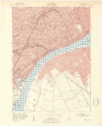
1954 Map of Detroit
USGS Topo · Published 1954About this map
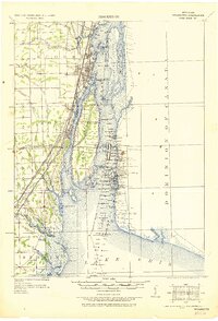
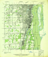
The Detroit River serves as the central artery for this mid-century international corridor, connecting Detroit with Windsor via the Ambassador Bridge and the Detroit-Windsor Tunnel. The landscape is defined by its industrial and civic density, from the sprawling facilities at Zug Island and the Short Cut Canal to the concentrated cultural district featuring the Institute of Arts and Wayne University. The transit-heavy nature of the era is evident in the numerous rail yards and lines, including the Michigan Central and Canadian Pacific, which supported the region's massive automotive and shipping economies. On the Michigan side, the grid is dotted with dozens of neighborhood schools like Cass High Sch and landmarks such as Briggs Stadium, while the Ontario side shows the emerging residential blocks of Sandwich West and Ojibway near St Marys Academy.
Find a feature on this map
98 named features on this map. Tap any name to fly to it.
Don’t see what you’re looking for? This feature index may not catch every label — zoom into the map to look around manually.
Map Details
Editions of this 1954 Detroit Map
2 editions found

Other maps of this area

1905 · Detroit
USGS Topo · 1:62,500
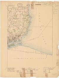
1905 · Grosse Pointe
USGS Topo · 1:62,500

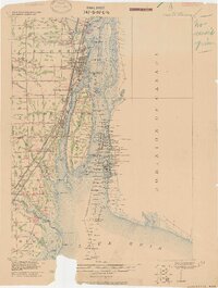
1906 · Wyandotte
USGS Topo · 1:62,500
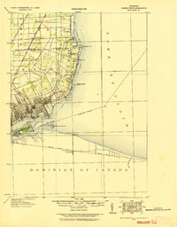
1912 · Wyandotte
USGS Topo · 1:62,500

1918 · Detroit
USGS Topo · 1:62,500
1918 · Grosse Pointe
USGS Topo · 1:62,500

1924 · Detroit
USGS Topo · 1:62,500
1929 · Wyandotte
USGS Topo · 1:62,500

1934 · Detroit
USGS Topo · 1:62,500
1936 · Wyandotte
USGS Topo · 1:31,680