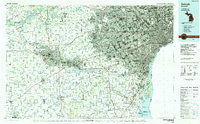
1985 Map of Detroit
USGS Topo · Published 1985About this map
The industrial corridor and residential expansion of Southeast Michigan are shown in high detail in the mid-1980s, revealing the dense infrastructure connecting Detroit to Ann Arbor. This era marks a significant point in the region's development, where massive automotive and transport networks like the Conrail and Norfolk and Western RR weave through established communities such as Dearborn and Livonia. The map highlights the dominance of the river systems, particularly the Detroit River and its industrial landmarks like Zug Island, alongside the suburban growth near Warren and Southfield.
Find a feature on this map
197 named features on this map. Tap any name to fly to it.
Don’t see what you’re looking for? This feature index may not catch every label — zoom into the map to look around manually.
Map Details
Editions of this 1985 Detroit Map
This is the sole edition of this map. No revisions or reprints were ever made.
Other maps of this area

1902 · South Lyon
USGS Topo · 1:62,500

1902 · Ypsilanti
USGS Topo · 1:62,500

1902 · Dexter
USGS Topo · 1:62,500

1904 · Ann Arbor
USGS Topo · 1:125,000

1905 · Wayne
USGS Topo · 1:62,500

1905 · Detroit
USGS Topo · 1:62,500

1905 · Grosse Pointe
USGS Topo · 1:62,500

1906 · Ypsilanti
USGS Topo · 1:62,500

1906 · Wyandotte
USGS Topo · 1:62,500

1906 · Dexter
USGS Topo · 1:62,500