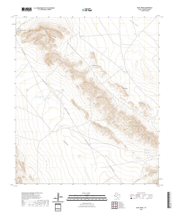
2022 Map of Devil Ridge
USGS Topo · Published 2022About this map
Devil Ridge dominates this arid landscape in Hudspeth County, serving as the central topographical spine between Red Light Draw and Blanca Draw. This modern survey by the U.S. Geological Survey details a region defined by high-altitude features like Yucca Mesa and Echo Canyon, where water management is critical for land use. The map tracks numerous livestock tanks or water catchments, including Fivemile Tank, Mac Tank, and the paired New Dagger Tank and Old Dagger Tank, which are vital nodes in this desert environment. Human presence is marked by primitive roads such as Indian Hot Springs Rd and Ranch Rd 1111, which navigate the slopes of Front Ridge and connect the scattered Red Hills to the surrounding Texas rangeland.
Find a feature on this map
19 named features on this map. Tap any name to fly to it.
Don’t see what you’re looking for? This feature index may not catch every label — zoom into the map to look around manually.
Map Details
Editions of this 2022 Devil Ridge Map
This is the sole edition of this map. No revisions or reprints were ever made.
Other maps of this area

1895 · Sierra Blanca
USGS Topo · 1:125,000

1897 · Eagle Mountain
USGS Topo · 1:125,000

1916 · Eagle Mountain
USGS Topo · 1:125,000

1954 · Van Horn
USGS Topo · 1:250,000

1958 · Van Horn
USGS Topo · 1:250,000

1959 · Marfa
USGS Topo · 1:250,000
1963 · Grayton Lake
USGS Topo · 1:24,000

1964 · Devil Ridge
USGS Topo · 1:24,000

1964 · Dome Peak
USGS Topo · 1:24,000

1964 · Lasca
USGS Topo · 1:24,000