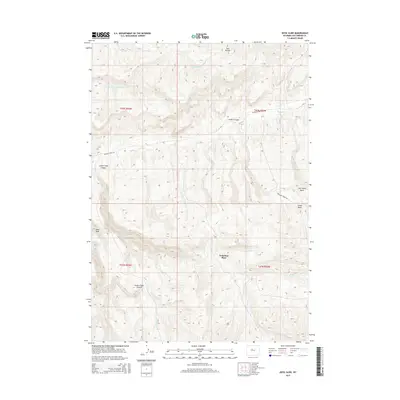
2015 Map of Devil Slide
USGS Topo · Published 2015About this map
Nickelson Place sits at the heart of this Hot Springs County landscape, where the high-altitude terrain of central Wyoming is defined by sharp canyons and isolated water sources. The map provides a detailed view of the complex drainage network including Jones Cr and Antelope Cr, which carve through deep formations like Jones Creek Canyon and Grass Creek Canyon. The topography is marked by significant landmarks such as the Twin Buttes in the north and the namesake Devil Slide to the west, illustrating the varied geological character of the region.
Find a feature on this map
20 named features on this map. Tap any name to fly to it.
Don’t see what you’re looking for? This feature index may not catch every label — zoom into the map to look around manually.
Map Details
Editions of this 2015 Devil Slide Map
This is the sole edition of this map. No revisions or reprints were ever made.
Other maps of this area

1951 · Boysen
USGS Topo · 1:24,000

1951 · Birdseye Pass
USGS Topo · 1:24,000

1952 · Guffy Peak
USGS Topo · 1:24,000

1955 · Thermopolis
USGS Topo · 1:250,000

1955 · Arminto
USGS Topo · 1:250,000

1958 · Thermopolis
USGS Topo · 1:250,000

1958 · Arminto
USGS Topo · 1:250,000

1960 · Devil Slide
USGS Topo · 1:24,000

1960 · Coyote Hill
USGS Topo · 1:24,000
1960 · Blue Hill
USGS Topo · 1:24,000