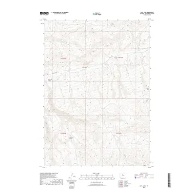
2017 Map of Devil Slide
USGS Topo · Published 2017About this map
Devil Slide rises as a prominent landmark in this corner of Hot Springs County, where the high desert terrain is defined by a series of deep drainages and isolated water sources. The landscape is carved by several major canyons, including Grass Creek Canyon and Grider Canyon, creating a complex network of ridges and basins. Life in this arid region is centered around vital hydrology like Moore Springs and the seasonal flows of Antelope Cr and Buffalo Cr.
Find a feature on this map
18 named features on this map. Tap any name to fly to it.
Don’t see what you’re looking for? This feature index may not catch every label — zoom into the map to look around manually.
Map Details
Editions of this 2017 Devil Slide Map
This is the sole edition of this map. No revisions or reprints were ever made.
Other maps of this area

1951 · Boysen
USGS Topo · 1:24,000

1951 · Birdseye Pass
USGS Topo · 1:24,000

1952 · Guffy Peak
USGS Topo · 1:24,000

1955 · Thermopolis
USGS Topo · 1:250,000

1955 · Arminto
USGS Topo · 1:250,000

1958 · Thermopolis
USGS Topo · 1:250,000

1958 · Arminto
USGS Topo · 1:250,000

1960 · Devil Slide
USGS Topo · 1:24,000

1960 · Coyote Hill
USGS Topo · 1:24,000
1960 · Blue Hill
USGS Topo · 1:24,000