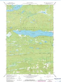
1960 Map of Devil Track Lake
USGS Topo · Published 1986About this map
Devil Track Lake dominates this portion of the Superior National Forest, serving as a central hub for Northwoods transportation and recreation. The map illustrates a landscape transitioning from the mid-century to the late 1980s, where the Grand Marais-Devil Track Airport and the specialized Sky Port Seaplane Base on the eastern shore highlight the area's reliance on aviation for access. Inland, the North Shore State Trail winds through a dense network of water bodies, including Pendant Lake, Digit Lake, and Junco Lake. The presence of numerous Gravel Pit sites suggests the ongoing maintenance of forest roads like those near Bally Creek. Elevations rise toward the south, culminating at Murphy Mountain and the prominent Sawtooth Bluff, providing a clear view of the topographic character of the Arrowhead region before it drops toward Lake Superior.
Find a feature on this map
26 named features on this map. Tap any name to fly to it.
Don’t see what you’re looking for? This feature index may not catch every label — zoom into the map to look around manually.
Map Details
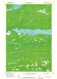
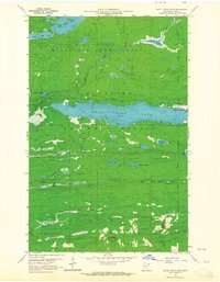
Editions of this 1960 Devil Track Lake Map
3 editions found
Other maps of this area

1919 · Brule Lake
USGS Topo · 1:62,500

1919 · Grand Marais
USGS Topo · 1:62,500

1919 · Lutsen
USGS Topo · 1:62,500

1954 · Two Harbors
USGS Topo · 1:250,000

1957 · Two Harbors
USGS Topo · 1:250,000

1958 · Two Harbors
USGS Topo · 1:250,000

1958 · Deer Yard Lake
USGS Topo · 1:24,000

1958 · Good Harbor Bay
USGS Topo · 1:24,000

1959 · Pine Mountain
USGS Topo · 1:24,000

1959 · Lima Mountain
USGS Topo · 1:24,000