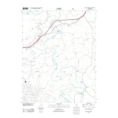
2012 Map of Devils Elbow
USGS Topo · Published 2012About this map
The Big Piney River carves a winding path through Pulaski County, anchoring a landscape defined by deep hollows and high ridges. Significant historical transportation routes intersect here, including a segment of the Trl Of Tears and the rail infrastructure at Lee Siding. The settlement patterns of the early 21st century are visible in the proximity of Morgan Heights and Devils Elbow, while the area's older history is preserved in numerous family and community burial grounds like Spaulding Cemetery, Hale Cemetery, and Rockwell Cemetery. Local topography is detailed through landmarks such as Spring Creek Bluff and Deckers Ridge, which overlook the river valley. Natural water sources like Shanghai Spring and Ousley Spring appear alongside the larger Gasconade River at the northern edge of the sheet.
Find a feature on this map
73 named features on this map. Tap any name to fly to it.
Don’t see what you’re looking for? This feature index may not catch every label — zoom into the map to look around manually.
Map Details
Editions of this 2012 Devils Elbow Map
This is the sole edition of this map. No revisions or reprints were ever made.
Other maps of this area

1912 · Rolla
USGS Topo · 1:62,500

1936 · Waynesville
USGS Topo · 1:48,000

1937 · Edgar Springs
USGS Topo · 1:48,000

1941 · Big Piney
USGS Topo · 1:62,500

1942 · Waynesville
USGS Topo · 1:62,500

1943 · Big Piney
USGS Topo · 1:62,500

1944 · Waynesville
USGS Topo · 1:62,500

1945 · Edgar Springs
USGS Topo · 1:62,500

1949 · Rolla
USGS Topo · 1:250,000

1950 · Newburg
USGS Topo · 1:24,000