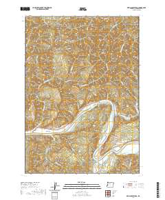
2020 Map of Devils Graveyard
USGS Topo · Published 2020About this map
Umpqua River frontage and the surrounding timberlands of Douglas County dominate this recent survey of the Oregon Coast Range. The river forms a sharp oxbow around Bunch Bar and rushes through Sawyers Rapids, illustrating the powerful hydrology that has shaped this landscape. Settlement is sparse, focused on the small clearing at Long Prairie and along the various creek drainages like Weatherly Creek and Paradise Cr.
Find a feature on this map
44 named features on this map. Tap any name to fly to it.
Don’t see what you’re looking for? This feature index may not catch every label — zoom into the map to look around manually.
Map Details
Editions of this 2020 Devils Graveyard Map
This is the sole edition of this map. No revisions or reprints were ever made.
Other maps of this area

1919 · Earl
USGS Topo · 1:48,000

1942 · Roman Nose Mtn
USGS Topo · 1:62,500

1943 · Goodwin Peak
USGS Topo · 1:62,500

1945 · Roman Nose Mtn
USGS Topo · 1:62,500

1955 · Scottsburg
USGS Topo · 1:62,500

1955 · Elkton
USGS Topo · 1:62,500
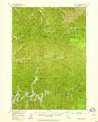
1956 · Goodwin Peak
USGS Topo · 1:62,500

1958 · Roseburg
USGS Topo · 1:250,000

1959 · Roseburg
USGS Topo · 1:250,000

1979 · Cottage Grove
USGS Topo · 1:100,000