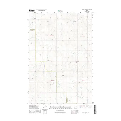
2017 Map of Devils Kitchen
USGS Topo · Published 2017About this map
Devils Kitchen serves as the namesake landmark for this segment of the eastern Montana plains, where the border of Yellowstone Co and Treasure Co follows the township line. The landscape is defined by an intricate network of seasonal drainages and topographic depressions, including Sand Coulee and Winter Camp Coulee. These features highlight the importance of water management in this arid region, evidenced by the presence of Horton Reservoir, Larsen Reservoir, and Teds Reservoir.
Find a feature on this map
26 named features on this map. Tap any name to fly to it.
Don’t see what you’re looking for? This feature index may not catch every label — zoom into the map to look around manually.
Map Details
Editions of this 2017 Devils Kitchen Map
This is the sole edition of this map. No revisions or reprints were ever made.
Other maps of this area

1954 · Forsyth
USGS Topo · 1:250,000

1957 · Forsyth
USGS Topo · 1:250,000

1958 · Forsyth
USGS Topo · 1:250,000

1960 · Bighorn
USGS Topo · 1:24,000

1960 · Coal Bank Creek
USGS Topo · 1:24,000

1960 · Custer
USGS Topo · 1:24,000

1960 · Rancher Cemetery
USGS Topo · 1:24,000

1960 · Mc Konkey Creek
USGS Topo · 1:24,000

1979 · Hysham
USGS Topo · 1:100,000
1979 · Devils Kitchen
USGS Topo · 1:24,000