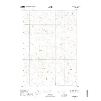
2020 Map of Devils Kitchen
USGS Topo · Published 2020About this map
The Devils Kitchen landform defines this central Montana landscape where the borders of Yellowstone and Treasure Counties meet. In this 2020 survey, the terrain is characterized by a complex network of seasonal drainages and coulees, reflecting a high-plains environment managed for water storage. Named reservoirs such as Horton Reservoir, Larsens Reservoir, and Teds Reservoir are scattered across the southeastern quads, serving as vital infrastructure for local ranching operations.
Find a feature on this map
27 named features on this map. Tap any name to fly to it.
Don’t see what you’re looking for? This feature index may not catch every label — zoom into the map to look around manually.
Map Details
Editions of this 2020 Devils Kitchen Map
This is the sole edition of this map. No revisions or reprints were ever made.
Other maps of this area

1954 · Forsyth
USGS Topo · 1:250,000

1957 · Forsyth
USGS Topo · 1:250,000

1958 · Forsyth
USGS Topo · 1:250,000

1960 · Bighorn
USGS Topo · 1:24,000

1960 · Coal Bank Creek
USGS Topo · 1:24,000

1960 · Custer
USGS Topo · 1:24,000

1960 · Rancher Cemetery
USGS Topo · 1:24,000

1960 · Mc Konkey Creek
USGS Topo · 1:24,000

1979 · Hysham
USGS Topo · 1:100,000
1979 · Devils Kitchen
USGS Topo · 1:24,000