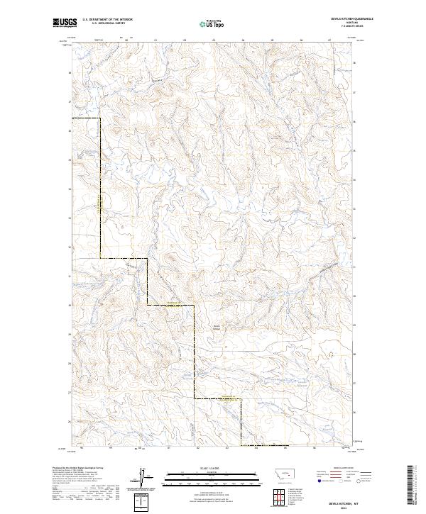
2024 Map of Devils Kitchen
USGS Topo · Published 2024About this map
Devils Kitchen sits at the heart of this landscape along the boundary of Yellowstone and Treasure Counties. This Montana terrain is defined by a complex network of ephemeral drainages and intermittent water storage, including Horton Reservoir, Larsens Reservoir, and Teds Reservoir. The topography transitions from high points like Sway Back to deep erosional features such as Rough Coulee and Winter Camp Coulee. The map shows a region shaped by natural drainage patterns rather than dense settlement, with the headwaters of North Fork Edwards Creek and Alkali Creek carving through the divide. Access to this territory is limited to a few documented routes like Sumatra Rd and the descriptively named Butt Camp Rd, reflecting the area's rural character and cattle-country heritage.
Find a feature on this map
28 named features on this map. Tap any name to fly to it.
Don’t see what you’re looking for? This feature index may not catch every label — zoom into the map to look around manually.
Map Details
Editions of this 2024 Devils Kitchen Map
This is the sole edition of this map. No revisions or reprints were ever made.
Other maps of this area

1954 · Forsyth
USGS Topo · 1:250,000

1957 · Forsyth
USGS Topo · 1:250,000

1958 · Forsyth
USGS Topo · 1:250,000

1960 · Bighorn
USGS Topo · 1:24,000

1960 · Coal Bank Creek
USGS Topo · 1:24,000

1960 · Custer
USGS Topo · 1:24,000

1960 · Rancher Cemetery
USGS Topo · 1:24,000

1960 · Mc Konkey Creek
USGS Topo · 1:24,000

1979 · Hysham
USGS Topo · 1:100,000
1979 · Devils Kitchen
USGS Topo · 1:24,000