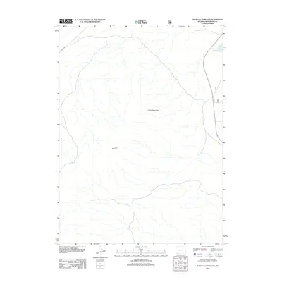
2012 Map of Devils Playground
USGS Topo · Published 2012About this map
Devils Playground and the surrounding high-altitude terrain of Sweetwater County define this portion of the Wyoming landscape as it appeared in the early 21st century. The northeastern corner of the map is dominated by the reach of Flaming Gorge Reservoir, a major hydrological feature on the Green River system. The interior is characterized by significant topographical elevations such as Black Mountain, while the western edge is accessed via Mckinnon Rd. A small water source, Pine Spring, provides a point of interest in an otherwise arid expanse of drainages and ridges. The map illustrates a region largely shaped by its natural landforms and the infrastructure required to manage water and access in a remote high-plains environment.
Find a feature on this map
5 named features on this map. Tap any name to fly to it.
Don’t see what you’re looking for? This feature index may not catch every label — zoom into the map to look around manually.
Map Details
Editions of this 2012 Devils Playground Map
This is the sole edition of this map. No revisions or reprints were ever made.
Other maps of this area

1954 · Rock Springs
USGS Topo · 1:250,000

1957 · Mc Kinnon Junction
USGS Topo · 1:62,500

1958 · Rock Springs
USGS Topo · 1:250,000

1962 · Rock Springs
USGS Topo · 1:250,000

1964 · Black Spring Reservoir
USGS Topo · 1:24,000
1964 · Antelope Wash
USGS Topo · 1:24,000

1964 · Winter Fat Reservoir
USGS Topo · 1:24,000

1966 · Mc Kinnon Junction
USGS Topo · 1:62,500

1966 · Buckboard Crossing
USGS Topo · 1:62,500
1980 · Firehole Canyon
USGS Topo · 1:100,000