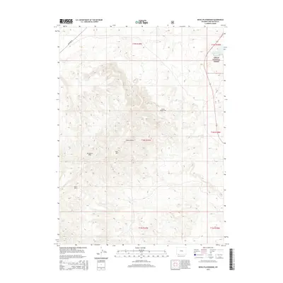
2015 Map of Devils Playground
USGS Topo · Published 2015About this map
The eponymous Devils Playground terrain dominates this portion of Sweetwater County, defined by a complex network of high-desert drainages and ridges. Elevated landmarks like Black Mtn rise above the surrounding flats, while seasonal water sources such as Pine Spring provide rare focal points in the arid landscape. To the northeast, the map shows the western edge of the Ashley National Forest, where the topography meets the shoreline of the Flaming Gorge Reservoir.
Find a feature on this map
18 named features on this map. Tap any name to fly to it.
Don’t see what you’re looking for? This feature index may not catch every label — zoom into the map to look around manually.
Map Details
Editions of this 2015 Devils Playground Map
This is the sole edition of this map. No revisions or reprints were ever made.
Other maps of this area

1954 · Rock Springs
USGS Topo · 1:250,000

1957 · Mc Kinnon Junction
USGS Topo · 1:62,500

1958 · Rock Springs
USGS Topo · 1:250,000

1962 · Rock Springs
USGS Topo · 1:250,000

1964 · Black Spring Reservoir
USGS Topo · 1:24,000
1964 · Antelope Wash
USGS Topo · 1:24,000

1964 · Winter Fat Reservoir
USGS Topo · 1:24,000

1966 · Mc Kinnon Junction
USGS Topo · 1:62,500

1966 · Buckboard Crossing
USGS Topo · 1:62,500
1980 · Firehole Canyon
USGS Topo · 1:100,000