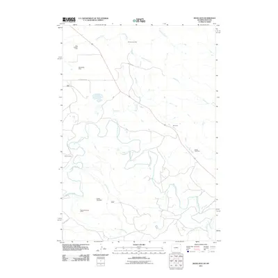
2011 Map of Devils Run
USGS Topo · Published 2011About this map
The Belle Fourche River meanders across this landscape on the border of Montana and Wyoming, carving a path through a region defined by livestock ranching and mineral extraction. Working cattle operations such as Raber Ranch, Bean Ranch, and Robinson Ranch are scattered throughout the territory, linked by gravel routes like Little Missouri Rd and Bentonite Rd. The latter road name points to the geological significance of the area, further evidenced by the Montana Creek Mine located in the northern reaches near Stoneville Flats. Water management is a critical feature of this high plains environment, as seen in the various stock dams including King Number 1 Dam, Newland Number 4 Dam, and Newby Creek Dam that capture runoff from seasonal drainages like Devils Run and Lone Tree Creek. From the heights of Green Mountain to the broad expanse of the flats, the map illustrates the 21st-century infrastructure of a sparsely populated but active agricultural and mining district.
Find a feature on this map
22 named features on this map. Tap any name to fly to it.
Don’t see what you’re looking for? This feature index may not catch every label — zoom into the map to look around manually.
Map Details
Editions of this 2011 Devils Run Map
This is the sole edition of this map. No revisions or reprints were ever made.
Other maps of this area

1901 · Aladdin
USGS Topo · 1:125,000

1903 · Aladdin
USGS Topo · 1:125,000

1954 · Ekalaka
USGS Topo · 1:250,000

1954 · Gillette
USGS Topo · 1:250,000

1955 · Gillette
USGS Topo · 1:250,000

1956 · Ekalaka
USGS Topo · 1:250,000

1957 · Mona
USGS Topo · 1:62,500

1957 · Colony
USGS Topo · 1:62,500

1958 · Gillette
USGS Topo · 1:250,000

1958 · Ekalaka
USGS Topo · 1:250,000