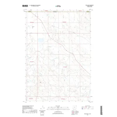
2017 Map of Devils Run
USGS Topo · Published 2017About this map
The Belle Fourche River meanders across this high plains borderland where Montana meets Wyoming. This region is defined by a dendritic network of drainages, including Devils Run, Montana Cr, and Arkansas Cr, which carve through the arid terrain near Stoneville Flats. The landscape transitions from these low-lying watercourses to significant elevations at Green Mtn in the southern portion of the quadrangle. Industrial and local transit is represented by specialized routes such as Bentonite Rd and Bariod Rd, suggesting the importance of local mineral extraction in this remote part of Carter and Crook Counties. The map provides a precise look at the township and range survey lines that partitioned this wide-open territory, illustrating how geography and resource management dictated the sparse settlement patterns and road networks like Stoneville Rd during the early 21st century.
Find a feature on this map
27 named features on this map. Tap any name to fly to it.
Don’t see what you’re looking for? This feature index may not catch every label — zoom into the map to look around manually.
Map Details
Editions of this 2017 Devils Run Map
This is the sole edition of this map. No revisions or reprints were ever made.
Other maps of this area

1901 · Aladdin
USGS Topo · 1:125,000

1903 · Aladdin
USGS Topo · 1:125,000

1954 · Ekalaka
USGS Topo · 1:250,000

1954 · Gillette
USGS Topo · 1:250,000

1955 · Gillette
USGS Topo · 1:250,000

1956 · Ekalaka
USGS Topo · 1:250,000

1957 · Mona
USGS Topo · 1:62,500

1957 · Colony
USGS Topo · 1:62,500

1958 · Gillette
USGS Topo · 1:250,000

1958 · Ekalaka
USGS Topo · 1:250,000