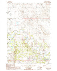
1984 Map of Devils Run
USGS Topo · Published 1985About this map
The Belle Fourche River meanders across this landscape on the Wyoming-Montana border, carving a complex path through the Stoneville Flats and past the high point of Green Mountain. Compiled from 1980 aerial photography, the map documents a working landscape of ranching and early-eighties resource extraction. Scattered ranching outposts such as Raber Ranch, Robinson Ranch, and Bean Ranch are connected by unimproved roads and 4WD tracks, emphasizing the area's isolation.
Find a feature on this map
22 named features on this map. Tap any name to fly to it.
Don’t see what you’re looking for? This feature index may not catch every label — zoom into the map to look around manually.
Map Details
Editions of this 1984 Devils Run Map
This is the sole edition of this map. No revisions or reprints were ever made.
Other maps of this area

1901 · Aladdin
USGS Topo · 1:125,000

1903 · Aladdin
USGS Topo · 1:125,000

1954 · Ekalaka
USGS Topo · 1:250,000

1954 · Gillette
USGS Topo · 1:250,000

1955 · Gillette
USGS Topo · 1:250,000

1956 · Ekalaka
USGS Topo · 1:250,000

1957 · Mona
USGS Topo · 1:62,500

1957 · Colony
USGS Topo · 1:62,500

1958 · Gillette
USGS Topo · 1:250,000

1958 · Ekalaka
USGS Topo · 1:250,000