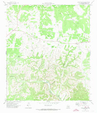
1971 Map of Devils Sinkhole
USGS Topo · Published 1973About this map
Devils Sinkhole (Cavern) dominates the central landscape of this Edwards County survey, a distinctive geological feature within a complex network of dry draws and seasonal creek beds. The 1971 data reveals a rugged Edwards Plateau environment where drainage patterns like Guthrie Draw, Hackberry Creek, and Deer Creek carve deep into the terrain. Human infrastructure is sparse, characterized by a utilitarian Landing Strip, a series of pipelines, and a private road network that suggests large-scale ranching or resource management.
Find a feature on this map
17 named features on this map. Tap any name to fly to it.
Don’t see what you’re looking for? This feature index may not catch every label — zoom into the map to look around manually.
Map Details
Editions of this 1971 Devils Sinkhole Map
2 editions found
Other maps of this area

1893 · Rock Springs
USGS Topo · 1:125,000

1893 · Nueces
USGS Topo · 1:125,000

1896 · Nueces
USGS Topo · 1:125,000

1947 · Hackberry
USGS Topo · 1:62,500

1954 · Llano
USGS Topo · 1:250,000

1954 · San Antonio
USGS Topo · 1:250,000

1954 · Sonora
USGS Topo · 1:250,000

1955 · Llano
USGS Topo · 1:250,000

1956 · Llano
USGS Topo · 1:250,000

1957 · San Antonio
USGS Topo · 1:250,000