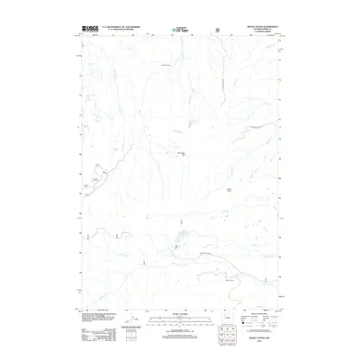
2012 Map of Devils Tooth
USGS Topo · Published 2012About this map
Shoshone Ranch and the Grabbert Cabin stand as notable human markers in this high-elevation landscape of Park County. The terrain is defined by a dense network of drainages including Marquette Cr, Carter Cr, and Hoodoo Cr, which flow through the open expanses of Pete Miller Park. This area's hydrology is characterized by small mountain lakes and man-made catchments like Hidden Lake, Foster Reservoir, and Coe Reservoir, reflecting the vital importance of water management in the Wyoming backcountry.
Find a feature on this map
25 named features on this map. Tap any name to fly to it.
Don’t see what you’re looking for? This feature index may not catch every label — zoom into the map to look around manually.
Map Details
Editions of this 2012 Devils Tooth Map
This is the sole edition of this map. No revisions or reprints were ever made.
Other maps of this area

1955 · Cody
USGS Topo · 1:250,000

1957 · Wapiti
USGS Topo · 1:62,500

1957 · Devils Tooth
USGS Topo · 1:62,500

1957 · Irish Rock
USGS Topo · 1:62,500

1957 · Sunshine Reservoir
USGS Topo · 1:62,500

1958 · Cody
USGS Topo · 1:250,000

1962 · Cody
USGS Topo · 1:250,000

1980 · Carter Mountain
USGS Topo · 1:100,000
1987 · Devils Tooth
USGS Topo · 1:24,000
1987 · Irma Flats
USGS Topo · 1:24,000