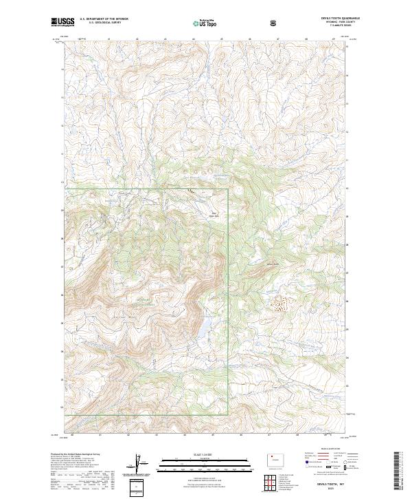
2023 Map of Devils Tooth
USGS Topo · Published 2023About this map
Shoshone National Forest dominates this high-elevation landscape, where the terrain rises sharply toward the distinctive Devils Tooth landmark. The area is defined by a complex drainage system feeding the Bighorn Basin, with Marquette Creek, Carter Creek, and Meeteetse Creek carving deep paths through the high plateaus. Managed water resources are evident in the presence of several upland impoundments, including Coe Reservoir, Foster Reservoir, and Darrah Number 2 Reservoir, which likely serve local ranching or irrigation needs in this arid environment. Navigation across this high country is limited to a few specific corridors like Hidden Lake Rd and the Marquette Access. Local landmarks like Pete Miller Park and the expansive Carter Mountain (also labeled as Carter Mtn) suggest a landscape utilized for both seasonal grazing and back-country recreation within the forest boundaries.
Find a feature on this map
31 named features on this map. Tap any name to fly to it.
Don’t see what you’re looking for? This feature index may not catch every label — zoom into the map to look around manually.
Map Details
Editions of this 2023 Devils Tooth Map
This is the sole edition of this map. No revisions or reprints were ever made.
Other maps of this area

1955 · Cody
USGS Topo · 1:250,000

1957 · Wapiti
USGS Topo · 1:62,500

1957 · Devils Tooth
USGS Topo · 1:62,500

1957 · Irish Rock
USGS Topo · 1:62,500

1957 · Sunshine Reservoir
USGS Topo · 1:62,500

1958 · Cody
USGS Topo · 1:250,000

1962 · Cody
USGS Topo · 1:250,000

1980 · Carter Mountain
USGS Topo · 1:100,000
1987 · Devils Tooth
USGS Topo · 1:24,000
1987 · Irma Flats
USGS Topo · 1:24,000