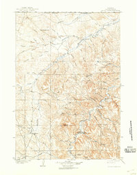
1905 Map of Devils Tower
USGS Topo · Published 1939About this map
Devils Tower National Monument anchors the southern portion of this landscape, which was surveyed just as the nation’s first national monument was established. The terrain is defined by the high plateaus and deep drainages of the Black Hills and the winding course of the Little Missouri River. Early ranching life is evident through remote outposts like Yeasts Ranch and Hulett Ranch, while the small settlement of Hulett serves as a rare pocket of concentrated habitation along the Fourche River.
Find a feature on this map
47 named features on this map. Tap any name to fly to it.
Don’t see what you’re looking for? This feature index may not catch every label — zoom into the map to look around manually.
Map Details
Editions of this 1905 Devils Tower Map
2 editions found
Other maps of this area

1898 · Sundance
USGS Topo · 1:125,000

1901 · Aladdin
USGS Topo · 1:125,000

1902 · Sundance
USGS Topo · 1:125,000

1903 · Aladdin
USGS Topo · 1:125,000

1905 · Devils Tower
USGS Topo · 1:125,000

1918 · Moorcroft
USGS Topo · 1:125,000

1918 · Moorcroft
USGS Topo · 1:62,500

1954 · Sunny Divide
USGS Topo · 1:24,000

1954 · Strawberry Hill
USGS Topo · 1:24,000

1954 · Storm Hill
USGS Topo · 1:24,000