
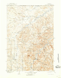
1905 Map of Devils Tower
USGS Topo · Published 1905About this map
The dramatic igneous intrusion of Devils Tower rises from the landscape of Crook County, while the distinctive Missouri Buttes stand as its western neighbors. Surveyed at the turn of the century, this map documents a sparsely settled frontier where early ranching operations like Hulett Ranch and Yeasts Ranch are identified alongside the established settlement of Hulett. The terrain is defined by a complex network of waterways, including the Little Missouri River and the North Fork Little Missouri River, which snake through canyons and gulches towards the Wyoming Montana Boundary Line. The absence of large-scale infrastructure highlights the reliance on local water sources and family-run land holdings, with named landmarks like Blackbank Hill and Strawberry Hill providing essential orientation for early 20th-century residents.
Find a feature on this map
48 named features on this map. Tap any name to fly to it.
Don’t see what you’re looking for? This feature index may not catch every label — zoom into the map to look around manually.
Map Details
Editions of this 1905 Devils Tower Map
2 editions found
Other maps of this area

1898 · Sundance
USGS Topo · 1:125,000

1901 · Aladdin
USGS Topo · 1:125,000

1902 · Sundance
USGS Topo · 1:125,000

1903 · Aladdin
USGS Topo · 1:125,000

1918 · Moorcroft
USGS Topo · 1:125,000

1918 · Moorcroft
USGS Topo · 1:62,500

1954 · Sunny Divide
USGS Topo · 1:24,000

1954 · Strawberry Hill
USGS Topo · 1:24,000

1954 · Storm Hill
USGS Topo · 1:24,000

1954 · Carlile
USGS Topo · 1:24,000