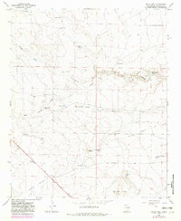
1967 Map of Devils Well
USGS Topo · Published 1982About this map
The Fort Stanton Fort Sumner Trail cuts diagonally across this high plains landscape, marking a historic corridor through the cattle country of De Baca County. This 1960s survey, updated in the early 1980s, reveals a terrain defined by its water sources—essential features for ranching survival—including Devils Well, Baker Well, and Morris Well. The land is deeply etched by seasonal drainages such as Burro Draw and the Arroyo de la Mora, which channel runoff toward the Pecos River basin. Notable geologic features like Diamond Cave and Owl Cave break the surface, while the presence of several earthen tanks, such as Buffalo Tank and Rock Canyon Tank, highlights the systematic efforts to capture water in this arid environment. The map also documents modern transit infrastructure, featuring a Roadside Park along the highway and industrial sites like the Triple Engel Pit.
Find a feature on this map
28 named features on this map. Tap any name to fly to it.
Don’t see what you’re looking for? This feature index may not catch every label — zoom into the map to look around manually.
Map Details
Editions of this 1967 Devils Well Map
2 editions found
Other maps of this area

1954 · Fort Sumner
USGS Topo · 1:250,000

1955 · Roswell
USGS Topo · 1:250,000

1958 · Fort Sumner
USGS Topo · 1:250,000

1958 · Roswell
USGS Topo · 1:250,000

1962 · Roswell
USGS Topo · 1:250,000

1967 · Wire Lake
USGS Topo · 1:24,000

1967 · Round Mountain
USGS Topo · 1:24,000

1967 · Dunlap NE
USGS Topo · 1:24,000

1967 · Dunlap Sill
USGS Topo · 1:24,000

1967 · Devils Well
USGS Topo · 1:24,000