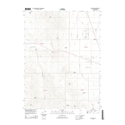
2014 Map of Devon Peak
USGS Topo · Published 2014About this map
Mahogany Hills and the Mountain Boy Range dominate this high-desert landscape in central Nevada. The terrain is defined by a series of prominent summits, including Devon Peak, Signal Peak, and Modoc Peak, which transition into the broad expanse of Diamond Valley. Transport and access follow the lower contours, with McCullough Springs RD and Whistler RD skirting the base of the ranges. The northeastern corner shows the residential street grid and industrial footprint of the Eureka Airport area, where roads like Minoletti Ranch Rd and Anderson Ranch Rd connect the valley floor. Steep drainage patterns are visible through Big Reilley Canyon and Swallow Canyon, while Slough Cr provides a primary watercourse through the northern flats.
Find a feature on this map
40 named features on this map. Tap any name to fly to it.
Don’t see what you’re looking for? This feature index may not catch every label — zoom into the map to look around manually.
Map Details
Editions of this 2014 Devon Peak Map
This is the sole edition of this map. No revisions or reprints were ever made.
Other maps of this area

1926 · Roberts Mountains
USGS Topo · 1:250,000

1929 · Roberts Mountains
USGS Topo · 1:250,000

1953 · Pinto Summit
USGS Topo · 1:62,500

1953 · Eureka
USGS Topo · 1:62,500

1955 · Millett
USGS Topo · 1:250,000

1956 · Bellevue Peak
USGS Topo · 1:62,500

1956 · Whistler Mtn
USGS Topo · 1:62,500

1956 · Ely
USGS Topo · 1:250,000

1959 · Ely
USGS Topo · 1:250,000

1959 · Millett
USGS Topo · 1:250,000