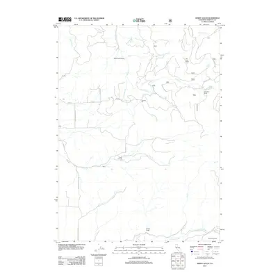
2012 Map of Dewey Gulch
USGS Topo · Published 2012About this map
Old White Mill stands as a central industrial landmark in this Siskiyou County landscape, situated near the confluence of the N Fork Bogus Cr and S Fork Bogus Cr. The map reveals a mountain economy shaped by timber and ranching, evidenced by the Old Schmidt Sawmill on the southern edge and family-named locations such as Sylva Brothers and Parker Camp. The terrain is deeply incised by drainages like Black Rock Canyon and Dewey Gulch, while open meadows like Old Lady Glade and Chandler Glade interrupt the forest. Transportation is defined by a network of forest routes and local roads, including Sylva Rd and Snowden Hovey Gulch Rd, which connect small named settlements such as Buckley, York, and Barba.
Find a feature on this map
35 named features on this map. Tap any name to fly to it.
Don’t see what you’re looking for? This feature index may not catch every label — zoom into the map to look around manually.
Map Details
Editions of this 2012 Dewey Gulch Map
This is the sole edition of this map. No revisions or reprints were ever made.
Other maps of this area

1886 · Shasta
USGS Topo · 1:250,000

1894 · Shasta
USGS Topo · 1:250,000

1922 · Shasta Valley Sheet No 12
USGS Topo · 1:24,000

1922 · Shasta Valley Sheet No 13
USGS Topo · 1:24,000

1934 · Macdoel
USGS Topo · 1:96,000

1941 · Macdoel
USGS Topo · 1:125,000

1948 · Weed
USGS Topo · 1:250,000

1950 · Weed
USGS Topo · 1:250,000

1954 · The Whaleback
USGS Topo · 1:62,500

1954 · Macdoel
USGS Topo · 1:62,500