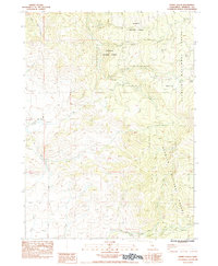
1984 Map of Dewey Gulch
USGS Topo · Published 1984About this map
Klamath National Forest defines the rugged geography of this Siskiyou County survey, where the drainages of Bogus Creek and the Little Shasta River converge. The landscape is marked by a complex network of water management and seasonal springs, including the notable Kuck Ditch and the isolated Black Rock Spring. This 1984 provisional edition highlights the traces of human activity in an otherwise remote terrain, noting the former Parker Camp (Site) and scattered Ruins that suggest earlier settlement or grazing operations. The map details numerous smaller canyons and draws such as Dewey Gulch, Fogg Gulch, and York Draw, alongside 4WD tracks and the Steep Trail, illustrating how the region's cattle or timber resources were accessed in the late 20th century.
Find a feature on this map
23 named features on this map. Tap any name to fly to it.
Don’t see what you’re looking for? This feature index may not catch every label — zoom into the map to look around manually.
Map Details
Editions of this 1984 Dewey Gulch Map
This is the sole edition of this map. No revisions or reprints were ever made.
Other maps of this area

1886 · Shasta
USGS Topo · 1:250,000

1894 · Shasta
USGS Topo · 1:250,000

1922 · Shasta Valley Sheet No 12
USGS Topo · 1:24,000

1922 · Shasta Valley Sheet No 13
USGS Topo · 1:24,000

1934 · Macdoel
USGS Topo · 1:96,000

1941 · Macdoel
USGS Topo · 1:125,000

1948 · Weed
USGS Topo · 1:250,000

1950 · Weed
USGS Topo · 1:250,000

1954 · The Whaleback
USGS Topo · 1:62,500

1954 · Macdoel
USGS Topo · 1:62,500