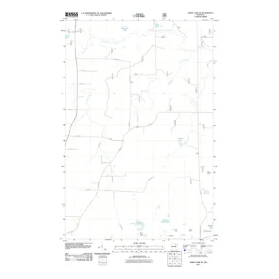
2011 Map of Dewey Lake SE
USGS Topo · Published 2011About this map
Grant Mine, Wabigon Mine, and Shiras Mine dominate the southern landscape of this Iron Range quadrangle, reflecting the deep industrial roots of Saint Louis County. This 2011 survey reveals a complex network of resource extraction and water management, notably the large Wabigone Tailings Basin and the nearby Croxtrom Pond. North of the mining activity, the terrain shifts into a hydraulic system of wetlands and meandering waterways, including Slow Creek and the East Branch Sturgeon River. The map captures a grid of rural roads named for local families—such as Smolcich Rd, Pozar Rd, and Seppala Rd—linking scattered homesteads to landmarks like the Buhl Lookout Tower. This era shows the continued coexistence of heavy industry alongside natural features like McNiven Lake and Moska Lake.
Find a feature on this map
32 named features on this map. Tap any name to fly to it.
Don’t see what you’re looking for? This feature index may not catch every label — zoom into the map to look around manually.
Map Details
Editions of this 2011 Dewey Lake SE Map
This is the sole edition of this map. No revisions or reprints were ever made.
Other maps of this area

1951 · Kinney
USGS Topo · 1:24,000

1951 · Kirk
USGS Topo · 1:24,000

1951 · Hibbing
USGS Topo · 1:24,000

1951 · Buhl
USGS Topo · 1:24,000

1952 · Idington
USGS Topo · 1:24,000

1954 · Hibbing
USGS Topo · 1:250,000

1955 · Dark Lake
USGS Topo · 1:24,000

1955 · Dewey Lake SE
USGS Topo · 1:24,000

1955 · Dewey Lake NW
USGS Topo · 1:24,000

1955 · Dewey Lake
USGS Topo · 1:24,000