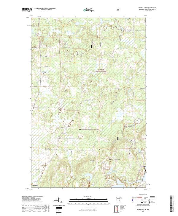
2022 Map of Dewey Lake SE
USGS Topo · Published 2022About this map
The Laurentian Divide cuts through this portion of the Mesabi Range, marking a significant geographical boundary where waters flow either toward the Arctic Ocean or the Atlantic. This northern Minnesota landscape is defined by the legacy of iron mining and timber management, with the Wabigong Tailings Basin south of Kinney illustrating the scale of industrial modification to the terrain. Much of the northern area falls within the Superior National Forest, where a network of forest roads like Barrett Road and the Doherty Spur C provide access to the dense woodlands and scattered water bodies including Deepwater Lake and McNiven Lake. The transition from the developed mining settlements of Buhl and Chisholm in the south to the protected forest tracts reflects the dual economic identity of St. Louis County.
Find a feature on this map
58 named features on this map. Tap any name to fly to it.
Don’t see what you’re looking for? This feature index may not catch every label — zoom into the map to look around manually.
Map Details
Editions of this 2022 Dewey Lake SE Map
This is the sole edition of this map. No revisions or reprints were ever made.
Other maps of this area

1951 · Kinney
USGS Topo · 1:24,000

1951 · Kirk
USGS Topo · 1:24,000

1951 · Hibbing
USGS Topo · 1:24,000

1951 · Buhl
USGS Topo · 1:24,000

1952 · Idington
USGS Topo · 1:24,000

1954 · Hibbing
USGS Topo · 1:250,000

1955 · Dark Lake
USGS Topo · 1:24,000

1955 · Dewey Lake SE
USGS Topo · 1:24,000

1955 · Dewey Lake NW
USGS Topo · 1:24,000

1955 · Dewey Lake
USGS Topo · 1:24,000