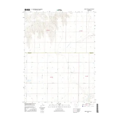
2015 Map of Dewey Ranch SE
USGS Topo · Published 2015About this map
Beaver Cr flows through the northern reaches of this High Plains landscape, where the border between Rawlins and Thomas counties divides a territory defined by section-line roads and intermittent drainage. The topographic survey reveals the gradual incision of the N Fork Sappa Cr and Middle Fork Sappa Cr, watercourses that have shaped the prairie into a series of draws and plateaus. Transport across this agricultural expanse is anchored by the north-south Brewster Hwy and a network of named local routes like Co Rd EE and Co Rd BB. This 2015 data reflects the modern persistence of the Public Land Survey System, with township and range lines such as t5s r36w and t6s r35w providing a rigid grid for the remote ranchlands and seasonal stream beds of Northwest Kansas.
Find a feature on this map
24 named features on this map. Tap any name to fly to it.
Don’t see what you’re looking for? This feature index may not catch every label — zoom into the map to look around manually.
Map Details
Editions of this 2015 Dewey Ranch SE Map
This is the sole edition of this map. No revisions or reprints were ever made.
Other maps of this area

1943 · Colby
USGS Topo · 1:62,500

1951 · Chardon
USGS Topo · 1:62,500

1951 · Dewey Ranch
USGS Topo · 1:62,500

1954 · Goodland
USGS Topo · 1:250,000

1956 · Goodland
USGS Topo · 1:250,000

1957 · Goodland
USGS Topo · 1:250,000

1966 · Brewster NW
USGS Topo · 1:24,000

1967 · Brewster NE
USGS Topo · 1:24,000

1967 · Levant
USGS Topo · 1:24,000
1981 · Dewey Ranch SW
USGS Topo · 1:24,000