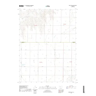
2018 Map of Dewey Ranch SE
USGS Topo · Published 2018About this map
Beaver Cr meanders across the high plains of northwest Kansas, anchoring a landscape defined by the expansive agricultural grids of the late 2010s. This survey, produced by the U.S. Geological Survey, captures the intersection of Rawlins Co and Thomas Co, where the sectional survey lines dictate the movement of local traffic. The Brewster Hwy serves as the primary north-south artery on the western edge of the quadrangle, linking the sparse homesteads and farming operations that dot this prairie terrain.
Find a feature on this map
22 named features on this map. Tap any name to fly to it.
Don’t see what you’re looking for? This feature index may not catch every label — zoom into the map to look around manually.
Map Details
Editions of this 2018 Dewey Ranch SE Map
This is the sole edition of this map. No revisions or reprints were ever made.
Other maps of this area

1943 · Colby
USGS Topo · 1:62,500

1951 · Chardon
USGS Topo · 1:62,500

1951 · Dewey Ranch
USGS Topo · 1:62,500

1954 · Goodland
USGS Topo · 1:250,000

1956 · Goodland
USGS Topo · 1:250,000

1957 · Goodland
USGS Topo · 1:250,000

1966 · Brewster NW
USGS Topo · 1:24,000

1967 · Brewster NE
USGS Topo · 1:24,000

1967 · Levant
USGS Topo · 1:24,000
1981 · Dewey Ranch SW
USGS Topo · 1:24,000