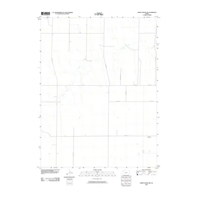
2009 Map of Dewey Ranch SW
USGS Topo · Published 2009About this map
Beaver Creek meanders through the heart of this landscape in Sherman County, Kansas, defining the drainage patterns of an area dominated by agricultural sections. The map reveals the rigid grid of the Public Land Survey System, where section lines are traced by a network of rural routes such as Co Rd 31, Co Rd 36, and County Line Rd. This geometry of the High Plains is punctuated by small, significant landmarks essential to the local community's history. Fairview Cemetery stands as a focal point for genealogical interest, located near the intersection of Co Rd 77 and Co Rd 391. The transition from the flat tableland to the gentle breaks of the creek valley shows the subtle topography that influenced early farmstead placement and road development in this western portion of the state.
Find a feature on this map
14 named features on this map. Tap any name to fly to it.
Don’t see what you’re looking for? This feature index may not catch every label — zoom into the map to look around manually.
Map Details
Editions of this 2009 Dewey Ranch SW Map
This is the sole edition of this map. No revisions or reprints were ever made.
Other maps of this area

1951 · Bird City South
USGS Topo · 1:62,500

1951 · Dewey Ranch
USGS Topo · 1:62,500

1954 · Goodland
USGS Topo · 1:250,000

1956 · Goodland
USGS Topo · 1:250,000

1957 · Goodland
USGS Topo · 1:250,000

1966 · Goodland NE
USGS Topo · 1:24,000

1966 · Brewster NW
USGS Topo · 1:24,000

1967 · Brewster NE
USGS Topo · 1:24,000
1981 · Dewey Ranch SW
USGS Topo · 1:24,000
1981 · Dewey Ranch
USGS Topo · 1:24,000