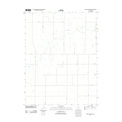
2012 Map of Dewey Ranch SW
USGS Topo · Published 2012About this map
Beaver Cr meanders across this High Plains landscape in Sherman County, forming the primary drainage through a highly organized agricultural grid. The terrain is defined by a rigorous section-line road network, where routes such as Road D, Road A, and Co Rd 391 mark the boundaries of industrial-scale farming operations. This 2012 survey shows the persistent geometry of the Kansas prairie, where the natural course of the creek provides the only deviation from the straight lines of rural infrastructure. Researchers of local land use will find a clear record of modern property access and water management, with numbered routes like Road 34 and Road 79 connecting the various tracts of this ranching and wheat-growing region.
Find a feature on this map
19 named features on this map. Tap any name to fly to it.
Don’t see what you’re looking for? This feature index may not catch every label — zoom into the map to look around manually.
Map Details
Editions of this 2012 Dewey Ranch SW Map
This is the sole edition of this map. No revisions or reprints were ever made.
Other maps of this area

1951 · Bird City South
USGS Topo · 1:62,500

1951 · Dewey Ranch
USGS Topo · 1:62,500

1954 · Goodland
USGS Topo · 1:250,000

1956 · Goodland
USGS Topo · 1:250,000

1957 · Goodland
USGS Topo · 1:250,000

1966 · Goodland NE
USGS Topo · 1:24,000

1966 · Brewster NW
USGS Topo · 1:24,000

1967 · Brewster NE
USGS Topo · 1:24,000
1981 · Dewey Ranch SW
USGS Topo · 1:24,000
1981 · Dewey Ranch
USGS Topo · 1:24,000