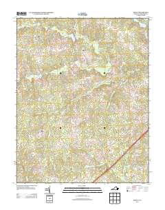
2013 Map of DeWitt
USGS Topo · Published 2013About this map
DeWitt and Butterworth anchor the southeastern portion of this Dinwiddie County landscape, positioned along a transportation corridor that includes the historic Boydton Plank Rd. The region is defined by a dense network of watercourses, including Stony Creek and the meandering Rocky Run Creek, which flow through a terrain marked by small crossings and scattered rural clusters like Baltimore Corner.
Find a feature on this map
51 named features on this map. Tap any name to fly to it.
Don’t see what you’re looking for? This feature index may not catch every label — zoom into the map to look around manually.
Map Details
Editions of this 2013 DeWitt Map
This is the sole edition of this map. No revisions or reprints were ever made.
Other maps of this area

1897 · Amelia
USGS Topo · 1:125,000

1918 · Lawrenceville
USGS Topo · 1:62,500

1919 · Mc Kenney
USGS Topo · 1:48,000

1920 · Lawrenceville
USGS Topo · 1:48,000

1921 · Mc Kenney
USGS Topo · 1:62,500

1921 · Lawrenceville
USGS Topo · 1:62,500

1942 · Lawrenceville
USGS Topo · 1:62,500

1943 · Mc Kenney
USGS Topo · 1:62,500

1943 · De Witt
USGS Topo · 1:24,000

1943 · Dinwiddie
USGS Topo · 1:24,000