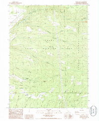
1985 Map of Dewitt Peak
USGS Topo · Published 1985About this map
Dewitt Peak rises above a landscape defined by seasonal drainages and remote homesteads in eastern Tehama County during the mid-1980s. This territory is largely dominated by the Tehama State Wildlife Area, where the rugged terrain transitions from the Mud Springs Plains into the western edges of the Lassen National Forest. For genealogists and local historians, the map is remarkably specific in its naming of small family-named sites, such as the Facht Homestead, Rasmussen Cabin, and Thompson Place. These locations, many situated along Antelope Creek or its tributaries like Little Grapevine Creek, reveal a history of isolated cattle ranching and seasonal camps. The presence of the Underground Telephone Line and a high-voltage Steel Tower Trans Line cutting north-to-south provides a striking contrast between modern infrastructure and the primary wilderness character of the ridge systems, including Speegle Ridge and Willow Tree Ridge.
Find a feature on this map
38 named features on this map. Tap any name to fly to it.
Don’t see what you’re looking for? This feature index may not catch every label — zoom into the map to look around manually.
Map Details
Editions of this 1985 Dewitt Peak Map
This is the sole edition of this map. No revisions or reprints were ever made.
Other maps of this area

1886 · Lassen Peak
USGS Topo · 1:250,000

1890 · Red Bluff
USGS Topo · 1:250,000

1892 · Lassen Peak
USGS Topo · 1:250,000

1894 · Lassen Peak
USGS Topo · 1:250,000

1894 · Red Bluff
USGS Topo · 1:250,000

1905 · Tehama
USGS Topo · 1:62,500

1935 · Paynes Creek
USGS Topo · 1:96,000

1941 · Mineral
USGS Topo · 1:125,000

1944 · Tuscan Buttes
USGS Topo · 1:62,500

1947 · Tuscan Buttes
USGS Topo · 1:62,500