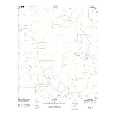
2010 Map of Dewville
USGS Topo · Published 2010About this map
Dewville serves as the focal point of this rural Gonzales County landscape, situated near the intersection of several local routes such as FM 1117 and Dewberry Rd. The area is defined by a dendritic network of waterways, including Sandies Creek, Tidwell Creek, and O'Neal Creek, which carve through the terrain and support the region's agricultural and ranching operations. Ranching heritage is prominently visible through named properties like Quien Sabe Ranch and Wells Ranch, while the local topography rises toward the north at Capote Hills and the distinct Capote Knob. Cultural and genealogical markers are centered around the community of Dewville, which preserves historical sites such as the Dewville Cemetery and Sandy Chapel Cemetery. The presence of several dams and reservoirs, including Quien Sabe Lake Number 2, illustrates the importance of water management in this cattle-ranching territory at the start of the 21st century.
Find a feature on this map
45 named features on this map. Tap any name to fly to it.
Don’t see what you’re looking for? This feature index may not catch every label — zoom into the map to look around manually.
Map Details
Editions of this 2010 Dewville Map
This is the sole edition of this map. No revisions or reprints were ever made.
Other maps of this area

1911 · San Marcos
USGS Topo · 1:125,000

1919 · San Marcos
USGS Topo · 1:125,000

1920 · Smiley
USGS Topo · 1:125,000

1924 · San Marcos 3-c
USGS Topo · 1:48,000

1924 · San Marcos 3-d
USGS Topo · 1:48,000

1925 · San Marcos 4-c
USGS Topo · 1:48,000

1929 · Luling
USGS Topo · 1:62,500

1930 · Seguin
USGS Topo · 1:62,500

1942 · Dewville
USGS Topo · 1:62,500

1953 · Seguin
USGS Topo · 1:250,000