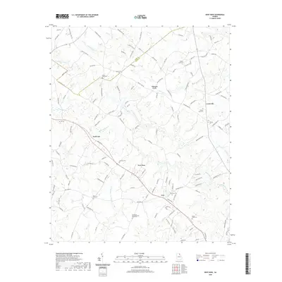
2020 Map of Dewy Rose
USGS Topo · Published 2020About this map
Dewy Rose and the surrounding Elbert County countryside characterize this part of Georgia, where small communities and historical family burying grounds define the landscape. The geography is shaped by the winding paths of Beaverdam Creek and its many tributaries, including Little Beaverdam Cr and Gum Log Br. Along the primary thoroughfares, older settlements like Hard Cash, Goss, and the descriptive Thirteen Forks serve as local landmarks. The area's social history is deeply rooted in its religious sites, such as the Stinchcomb United Methodist Church, and a high concentration of cemeteries including Ruckers Grove Cem and Oak Grove Cem. These sites, along with family-named roads like Thurmon Adams Rd and Allen Oglesby Rd, suggest a long-standing rural community structure that persisted into the twenty-first century.
Find a feature on this map
135 named features on this map. Tap any name to fly to it.
Don’t see what you’re looking for? This feature index may not catch every label — zoom into the map to look around manually.
Map Details
Editions of this 2020 Dewy Rose Map
This is the sole edition of this map. No revisions or reprints were ever made.
Other maps of this area

1891 · Carnesville
USGS Topo · 1:125,000

1893 · Elberton
USGS Topo · 1:125,000

1954 · Greenville
USGS Topo · 1:250,000

1958 · Greenville
USGS Topo · 1:250,000

1958 · Danielsville
USGS Topo · 1:62,500

1958 · Elberton
USGS Topo · 1:62,500

1959 · Hartwell Dam
USGS Topo · 1:24,000

1959 · Royston
USGS Topo · 1:24,000

1959 · Hartwell
USGS Topo · 1:24,000
1972 · Bowman
USGS Topo · 1:24,000