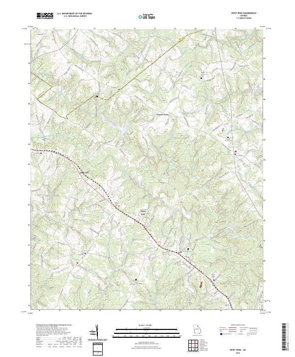
2024 Map of Dewy Rose
USGS Topo · Published 2024About this map
The settlement of Dewy Rose sits at the heart of this landscape along the border of Elbert and Hart counties. The area is defined by a dense network of family-named roads and country burial grounds, reflecting generations of rural Georgia lineage. Notable locations such as Hard Cash and Goss are positioned near the numerous creek branches that drain the terrain, including Little Beaverdam Creek and Deep Creek. The map provides a detailed view of the spiritual and communal geography of the region, featuring several longstanding religious sites like Stinchcomb United Methodist Church and the Whites Chapel Cem. The irregular property and road patterns, such as those found at Thirteen Forks, suggest a history of settlement based on topography and water access rather than rigid grid planning. This survey is particularly useful for those tracing family roots through the many dispersed sites like Liberty Cem and Rucker Grove Cem.
Find a feature on this map
138 named features on this map. Tap any name to fly to it.
Don’t see what you’re looking for? This feature index may not catch every label — zoom into the map to look around manually.
Map Details
Editions of this 2024 Dewy Rose Map
This is the sole edition of this map. No revisions or reprints were ever made.
Other maps of this area

1891 · Carnesville
USGS Topo · 1:125,000

1893 · Elberton
USGS Topo · 1:125,000

1954 · Greenville
USGS Topo · 1:250,000

1958 · Greenville
USGS Topo · 1:250,000

1958 · Danielsville
USGS Topo · 1:62,500

1958 · Elberton
USGS Topo · 1:62,500

1959 · Hartwell Dam
USGS Topo · 1:24,000

1959 · Royston
USGS Topo · 1:24,000

1959 · Hartwell
USGS Topo · 1:24,000
1972 · Bowman
USGS Topo · 1:24,000