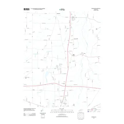
2013 Map of Dexter
USGS Topo · Published 2013About this map
Clarks River meanders through this portion of Calloway County, defining the drainage patterns for a network of local waterways including W Fork Rockhouse Cr and E Fork Rockhouse Cr. The landscape is dotted with several long-established small communities, most notably Dexter, Wadesboro, and Almo, which are connected by a grid of rural routes and farm-to-market roads. Local history and genealogy are well-represented by the inclusion of Stewart Cem and Bethel Cem, alongside more modern landmarks such as the Murray Memorial Gardens. The presence of Kyle-Oakley Field Airport and Turner Field Airport indicates the area's continued role as a regional transit hub, even as it maintains its traditional character centered around these quiet settlements.
Find a feature on this map
119 named features on this map. Tap any name to fly to it.
Don’t see what you’re looking for? This feature index may not catch every label — zoom into the map to look around manually.
Map Details
Editions of this 2013 Dexter Map
This is the sole edition of this map. No revisions or reprints were ever made.
Other maps of this area

1936 · Hazel
USGS Topo · 1:24,000

1936 · New Concord
USGS Topo · 1:24,000

1936 · Oak Level
USGS Topo · 1:24,000

1936 · Lynn Grove
USGS Topo · 1:24,000

1936 · Hardin
USGS Topo · 1:24,000

1936 · Hiatt
USGS Topo · 1:24,000

1936 · Benton
USGS Topo · 1:48,000

1936 · Golden Pond
USGS Topo · 1:48,000

1936 · Dexter
USGS Topo · 1:24,000

1936 · Hico
USGS Topo · 1:24,000