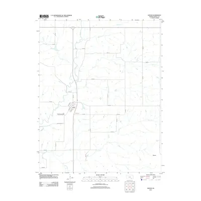
2012 Map of Dexter
USGS Topo · Published 2012About this map
Dexter serves as the primary hub of this eastern Cowley County landscape, situated where the terrain is carved by the winding course of Grouse Cr. The town's grid is centered around S Main St, Mulberry St, and Cherry St, with the local Po and the nearby Dexter Cem providing essential points of interest for genealogical research. The surrounding countryside is defined by a dense network of drainage systems, including Turkey Cr, Plum Cr, and Bullington Cr, which feed into the larger creek valleys.
Find a feature on this map
35 named features on this map. Tap any name to fly to it.
Don’t see what you’re looking for? This feature index may not catch every label — zoom into the map to look around manually.
Map Details
Editions of this 2012 Dexter Map
This is the sole edition of this map. No revisions or reprints were ever made.
Other maps of this area

1889 · Burden
USGS Topo · 1:125,000

1955 · Wichita
USGS Topo · 1:250,000

1958 · Wichita
USGS Topo · 1:250,000
1962 · Cedar Vale West
USGS Topo · 1:24,000

1962 · Dexter SW
USGS Topo · 1:24,000

1962 · Grand Summit
USGS Topo · 1:24,000

1962 · Dexter
USGS Topo · 1:24,000
1962 · Dexter NE
USGS Topo · 1:24,000

1962 · Cambridge
USGS Topo · 1:24,000

1964 · Burden
USGS Topo · 1:24,000