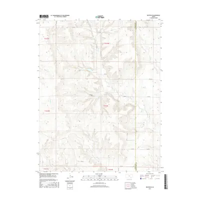
2015 Map of Dexter NE
USGS Topo · Published 2015About this map
Hogback Hill rises above the dissected plateau of the Flint Hills region at the border of Cowley Co and Chautauqua Co. This landscape is defined by its intricate drainage networks, where a series of small waterways including Jim Cr, Plum Cr, and Crabb Cr cut through the limestone-rich terrain. The map reflects a rural economy dominated by ranching and large-scale land divisions, evidenced by long arterial routes like Kansas Rd, Nation Rd, and Overland Rd.
Find a feature on this map
34 named features on this map. Tap any name to fly to it.
Don’t see what you’re looking for? This feature index may not catch every label — zoom into the map to look around manually.
Map Details
Editions of this 2015 Dexter NE Map
This is the sole edition of this map. No revisions or reprints were ever made.
Other maps of this area

1885 · Sedan
USGS Topo · 1:125,000

1889 · Burden
USGS Topo · 1:125,000

1889 · Sedan
USGS Topo · 1:125,000

1955 · Wichita
USGS Topo · 1:250,000

1958 · Wichita
USGS Topo · 1:250,000
1962 · Cedar Vale West
USGS Topo · 1:24,000

1962 · Dexter SW
USGS Topo · 1:24,000

1962 · Grand Summit
USGS Topo · 1:24,000

1962 · Dexter
USGS Topo · 1:24,000
1962 · Cedar Vale East
USGS Topo · 1:24,000