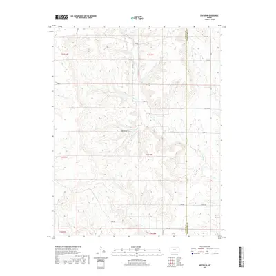
2018 Map of Dexter NE
USGS Topo · Published 2018About this map
Hogback Hill rises above the dissected ranchlands of eastern Cowley County, marking a landscape defined by an intricate network of drainage creeks. This area is characterized by long-established cattle operations and rural road networks that follow the section lines of the Public Land Survey System, including 162nd Rd and Kansas Rd. The boundary between Cowley and Chautauqua counties runs vertically through the eastern portion of the map, separating the headwaters of several notable streams. Tributaries such as Jim Cr, Shafer Cr, and Crabb Cr carve through the terrain, while the larger Otter Creek flows through the southeastern reaches. The abundance of named rural routes, such as Priv Ranch Rd and Quivira Rd, suggests a landscape shaped by private landholding and high-plains agriculture.
Find a feature on this map
29 named features on this map. Tap any name to fly to it.
Don’t see what you’re looking for? This feature index may not catch every label — zoom into the map to look around manually.
Map Details
Editions of this 2018 Dexter NE Map
This is the sole edition of this map. No revisions or reprints were ever made.
Other maps of this area

1885 · Sedan
USGS Topo · 1:125,000

1889 · Burden
USGS Topo · 1:125,000

1889 · Sedan
USGS Topo · 1:125,000

1955 · Wichita
USGS Topo · 1:250,000

1958 · Wichita
USGS Topo · 1:250,000
1962 · Cedar Vale West
USGS Topo · 1:24,000

1962 · Dexter SW
USGS Topo · 1:24,000

1962 · Grand Summit
USGS Topo · 1:24,000

1962 · Dexter
USGS Topo · 1:24,000
1962 · Cedar Vale East
USGS Topo · 1:24,000